The Ministry of Culture (MiC) and the Research Centre for the Prediction, Prevention and Control of Geological Risks of the Sapienza University of Rome (CERI) have signed a collaboration agreement on cultural heritage, within the framework of the ‘Extraordinary Plan for the Monitoring and Preservation of Immovable Cultural Heritage’.
The aim of this research project is to identify ‘best practices’ among the various remote sensing techniques, both terrestrial and satellite, in order to understand how moniotracking technologies can be useful in the management and conservation of architectural and cultural heritage.
There are many natural and anthropic risk factors that alter the original situation: earthquakes, volcanic eruptions, landslides, floods, subsidence, climate change, pollution, fires, structural failure, and anthropic pressure. Faced with such a vast range of risk factors, there is an equally vast range of impacts, the control of which (which is the substance of monitoring) requires the acquisition of data and their processing models for multi-scale, multi-depth, multi-resolution, multi-sensing monitoring, and requires that the assets identified as being at greater risk of loss or damage be subjected to a system of controls aimed at enabling the timely initiation of the conservation measures necessary to safeguard the assets themselves, in the event of evident levels of criticality emerging during monitoring.
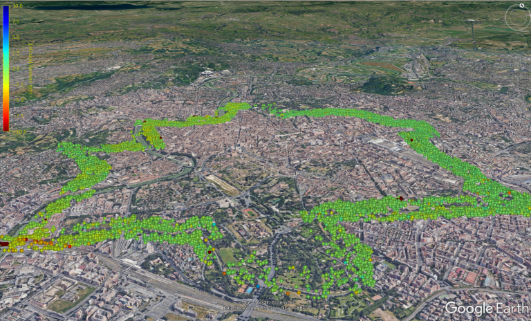
The identification of data requires a “holistic” approach: it is necessary to combine a global and top-down view of the site and territory with a high-resolution diagnostic of the individual structure (or individual element of the structure). This objective must be based on the integration of remote sensing technologies from different observational platforms: satellite, aerial (drones or different types of aircraft) and photographic (orthophotos), in combination with territorial surveys and with the acquisition of information by means of sensors (in-situ) directly applied on the buildings and punctual verifications of the state of structural and material degradation of the buildings.
Techniques used:
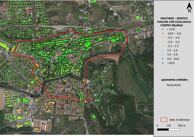
- A-DInSAR “Advanced Differential Interferometric Synthetic Aperture Radar”.
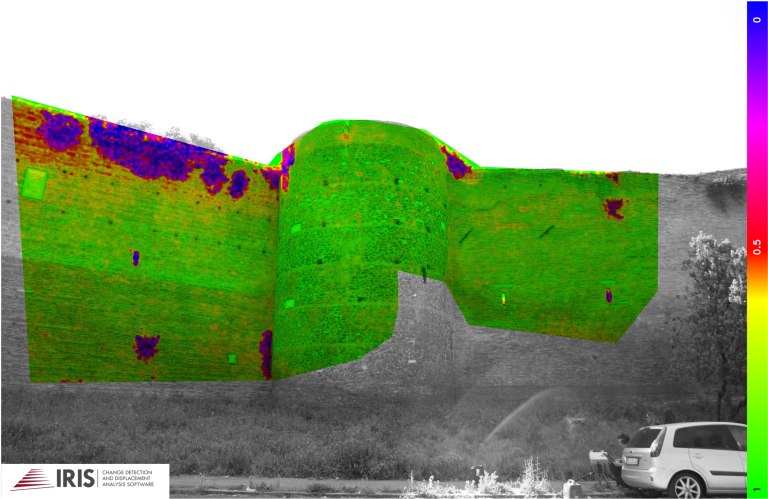
- CD “Change Detection
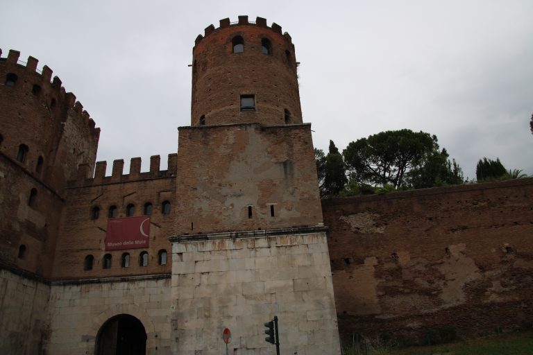
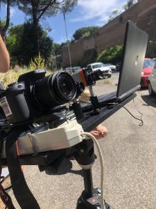
- Photomonitoring
- TinRAR “Terrestrial Radar Interferometry”.
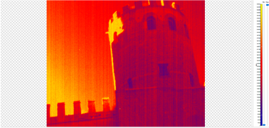
- LWIR and SWIR thermography
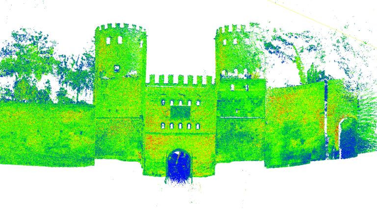
- 3D Laser Scanner Surveys