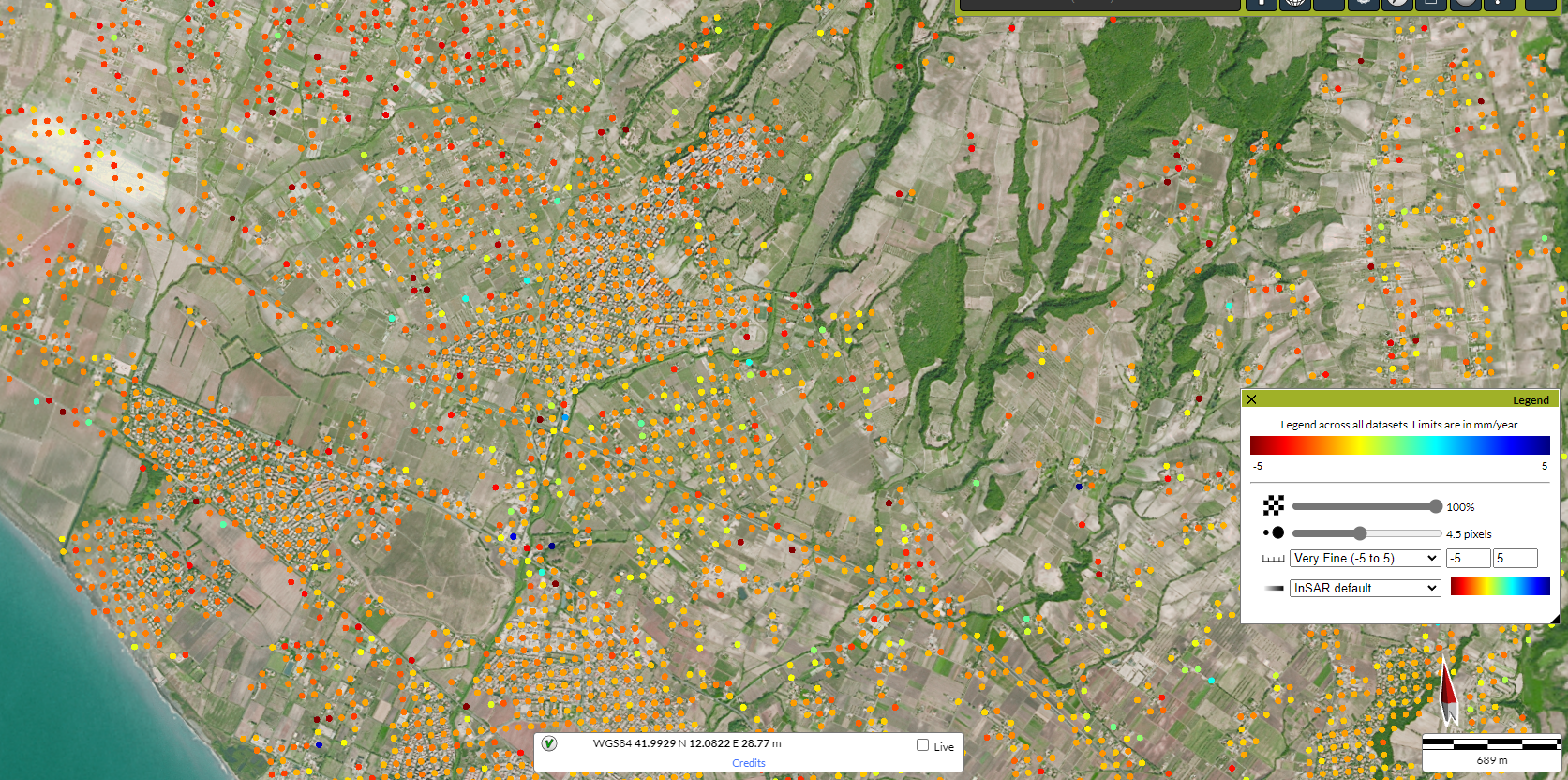
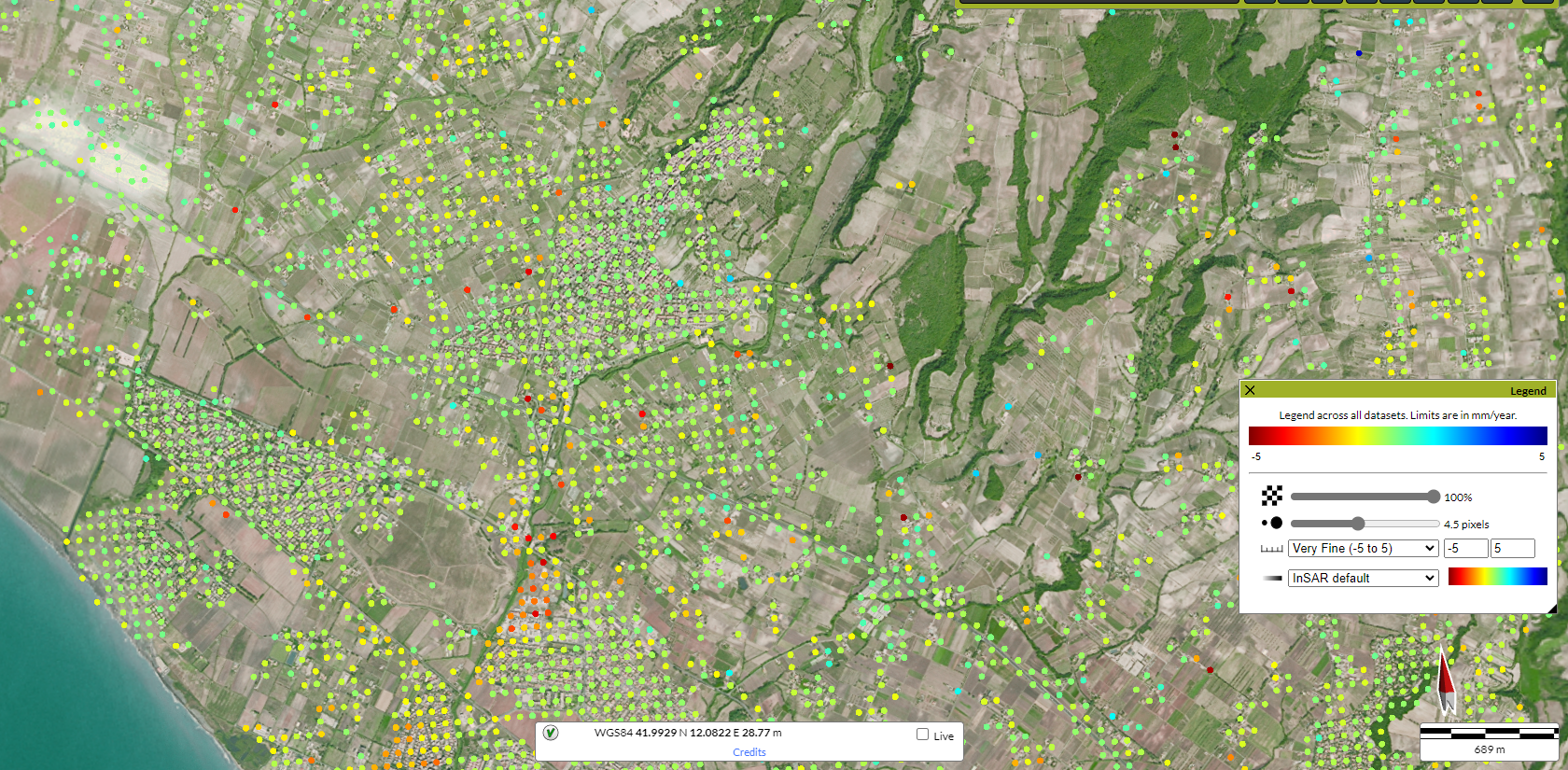
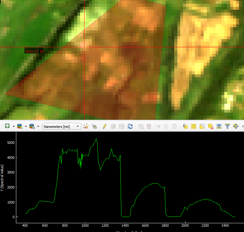
The ATLAS (Advanced Technologies for Cultural Heritage Safeguard) project is aimed at analysing the interaction between elements of the archaeological heritage and phenomena induced by environmental and anthropogenic factors, such as erosion, movement, change of use and land cover, potentially and in some cases, due to the ongoing climate change, already dramatically damaging the conservation of archaeological sites. The ATLAS project intends to develop and test on some Lazio case studies, of medium extension, an innovative functional procedure for risk assessment based on the integrated use of different methods of recording and monitoring soil processes by means of remote sensing techniques. The main objective is the development of special data processing chains obtained from the use of remote sensing technologies (including SAR satellite images at different bands) capable of monitoring soil phenomena and allowing for a more precise mapping of the exposed and buried archaeological heritage of sites. The Department of Earth Sciences of La Sapienza, University of Rome is participating in the ATLAS project with the task of analysing soil monitoring methodologies through image stack approaches such as the persistent scatterer technique in order to obtain maps and time series of soil displacements and structures.
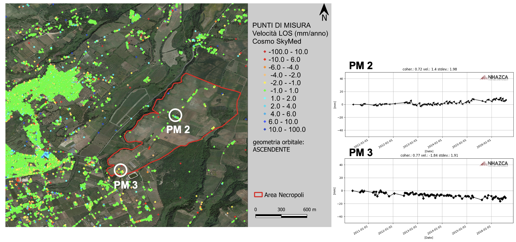
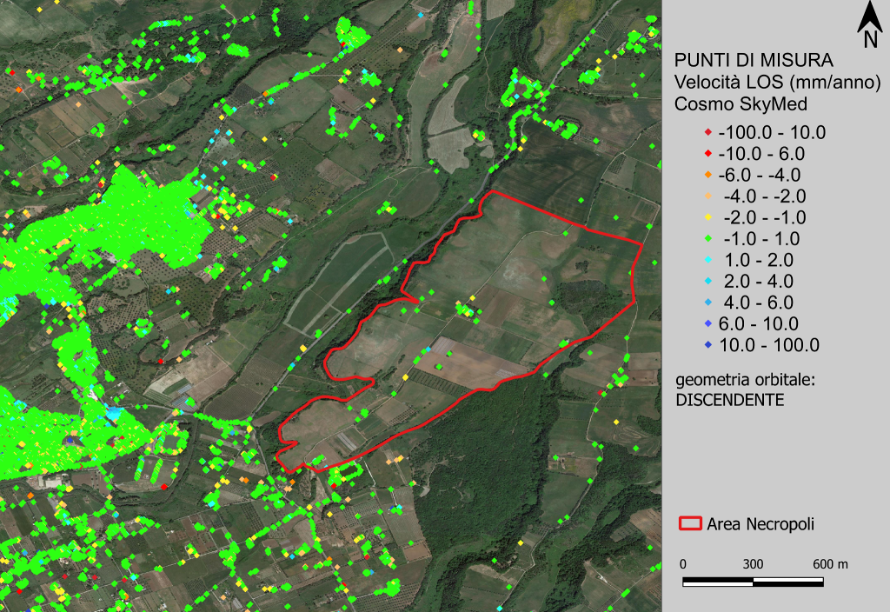
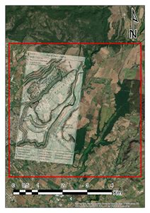
The case study of the DST is the Cerveteri necropolis.