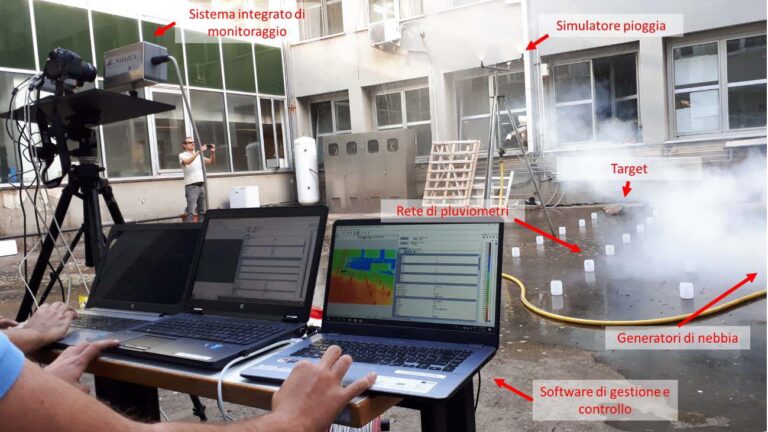
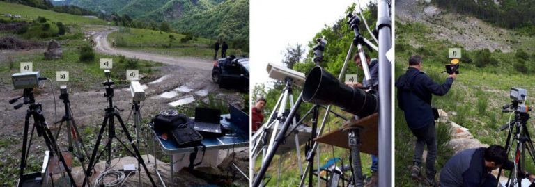
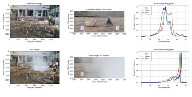
The millimeter waves (frequencies from 30 to 300 GigaHertz, wavelengths from 1 cm to 1 mm) allow to obtain images of road and rail infrastructure from medium distance (20-100 meters) sufficiently clear and resolved without undergoing atmospheric attenuation by absorption (water vapor) or diffusion (fog, dust, heavy rain). Furthermore, they do not require natural (sun) or visible (flash or lamps) illumination, and are not hazardous to health (non-ionizing). The recently developed technologies for millimeter waves allow the innovative use for the acquisition of images of obstacles on the roadways resulting from hydrogeological risk (landslides, flooding) through a real camera, instead of a simple measure of presence / distance of any obstacle typically carried out with radar technology.
The MARIIS project (All-Weather Monitoring of Hydrogeological Risk for Road and Rail Infrastructures) aims to develop in the laboratory, and then install in the field, a prototype of an automated millimeter wave image acquisition system able to
- acquire images of a given section of railway or road exposed to hydrogeological risk (called “intersection”);
- identify by means of an image analysis algorithm the presence of any obstacle that may compromise the safety of the intersection;
- send an alarm signal on an existing telecommunications network;
- demonstrate system operation 24 hours a day, 365 days a year, in all weather conditions (“all-weather”);
- take the first steps of intellectual property protection and commercial exploitation, starting from the data obtained with the prototype.
The project has been proposed by a Temporary Association of Purpose led by NHAZCA S.r.l. – Startup of the Sapienza University of Rome in the field of remote sensing – in partnership with CRISEL, leader in the design and supply of technological equipment for applications in advanced sectors, with the Department of Engineering of the University of Roma Tre, scientific partner of the project, and with the Italian Institute of Technology (IIT), an important national research center with the aim of promoting excellence in basic and applied research and promoting the development of the national economic system.