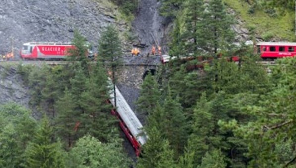
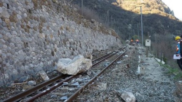
Real-time identification of landslides affecting railroad tracks and roads has become a critical issue for transportation safety. Automatic Change Detection is one of the most promising solutions for this application given the ability to automatically and continuously analyze the images collected by the cameras installed along the route to be monitored. Currently, the most common sensors for this application are based on optical cameras or microwave radar. However, optical cameras do not have the ability to acquire images at night and during adverse weather conditions (e.g., through fog), while, on the other hand, radars cannot provide a clear view of obstacles, causing frequent false positive alarms.
In order to solve the limitations of the monitoring methods presented above, in this project the implementation of newly developed micro-bolometer cameras for long-wave infrared beams has been proposed within a system, developed as a prototype, for rail/road surveillance.
The physical and technological aspects of the micro-bolometers will be analyzed and studied to optimally make identifiable the spectrum of a gray body, i.e., a physical object that partially absorbs incident electromagnetic radiation, of different types of rocks and debris. A prototype telescope for the identification of small objects will be built by designing and fabricating special mid- and long-range infrared optics. At the same time, a dedicated software based on Change Detection algorithms will be developed and calibrated for automatic identification of landslide broken areas on railways/roadways.
In the framework of the project, the prototype will be firstly tested in the natural landslides laboratories of the Department of Earth Sciences of the University “Sapienza” of Rome (Poggio Baldi and Acuto Natural Labs). Subsequently, in the selected locations along railways and roads will be identified with partners such as Rete Ferroviaria Nazionale Italiana (RFI) and Dipartimento Stradale Nazionale Italiano (ANAS). The commercial strategy will be left to future evaluation (spin-off, patenting or licensing), but preliminary steps of intellectual property protection will be considered during project development.